1. Introduction
Chennai, one of India’s fastest-growing metropolitan cities, has a dynamic real estate market influenced by factors such as infrastructure development, IT growth, migration, and urban planning. Identifying emerging residential hotspots is critical for investors, developers, and homebuyers seeking areas with high appreciation potential or improved livability.
Location-Based Analytics (LBA) provides the tools and methods to systematically map these hotspots by combining geospatial data with real estate, demographic, and infrastructure information.
2. Concept of Location-Based Analytics
Location-Based Analytics involves the collection, processing, and analysis of data tied to specific geographic locations to identify trends, patterns, and opportunities. In real estate, it enables:
- Mapping areas of high residential demand
- Predicting future price appreciation
- Understanding connectivity and infrastructure impact
- Evaluating amenity availability and quality of life
LBA integrates data from multiple sources—property prices, rental trends, population growth, infrastructure developments, and amenities—into a spatial framework for visualization and prediction.
3. Data Collection
Effective mapping requires diverse datasets:
A. Real Estate Market Data
- Historical sales prices and transaction volumes
- Rental trends
- Property inventory and new launches
- Price appreciation rates
This data helps identify areas with growing demand and investment potential.
B. Infrastructure and Connectivity Data
- Road networks and metro rail expansions
- Bus and railway hubs
- Proximity to employment zones
Transport-oriented development often drives residential growth, as seen along corridors like Old Mahabalipuram Road (OMR).
C. Demographic and Socioeconomic Data
- Population density and growth
- Migration patterns
- Income levels and employment trends
Areas with growing professional populations often see increased demand for residential housing.
D. Amenities and Livability Factors
- Schools, hospitals, parks, shopping areas
- Availability of grocery stores, restaurants, and recreational spaces
- Environmental factors like pollution and flood risk
Areas with better amenity access generally have higher long-term residential value.
4. Analytical Techniques
Once data is collected, several geospatial and analytical techniques can be applied:
A. Heatmaps
Heatmaps visually represent density or intensity of variables like:
- Real estate transactions
- Rental demand
- Availability of amenities
- Proximity to infrastructure
This quickly identifies high-demand zones and emerging hotspots.
B. Geographic Information Systems (GIS)
GIS platforms allow:
- Mapping property prices across neighborhoods
- Overlaying infrastructure and connectivity layers
- Creating accessibility maps showing travel times to workplaces or metro stations
This spatial analysis reveals the correlation between connectivity and residential growth.
C. Time-Series and Satellite Analysis
- Analyzing satellite imagery over time shows urban expansion patterns.
- Night-light intensity data helps estimate population concentration and growth.
D. Predictive Modeling
Machine learning models can forecast:
- Neighborhoods likely to see price appreciation
- Areas where infrastructure projects will have the greatest impact
- Locations with future residential demand
These models integrate historical trends, infrastructure data, and demographic factors to predict emerging hotspots.
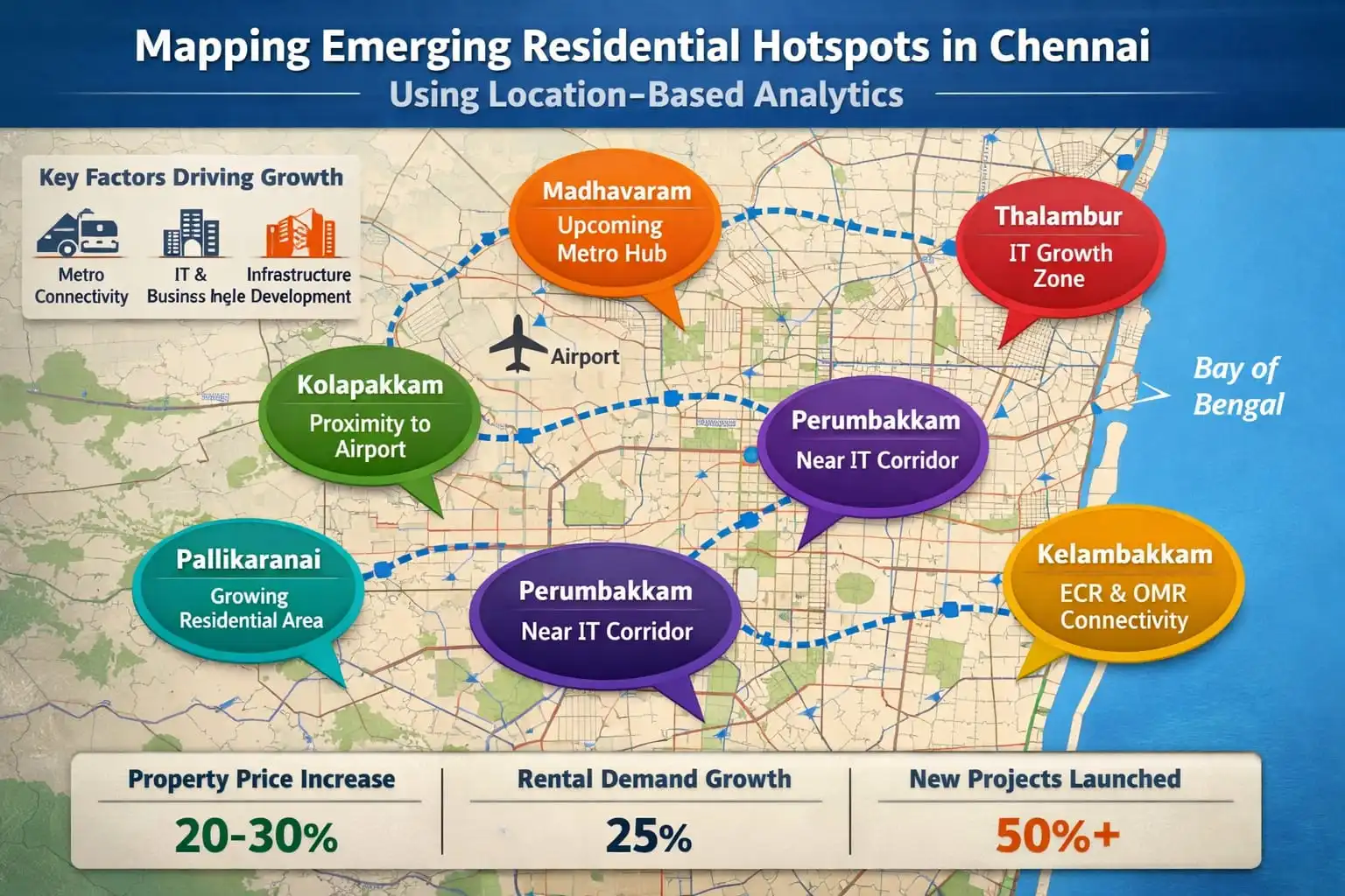
5. Identifying Emerging Hotspots in Chennai
By applying location-based analytics, several areas in Chennai are emerging as residential growth zones:
A. Old Mahabalipuram Road (OMR)
- IT corridor with increasing residential and rental demand
- Presence of tech parks attracts professionals
- Strong infrastructure development boosts property appreciation
B. Porur and Perumbakkam
- Suburban growth areas with affordable housing
- Improved connectivity to central business districts
- Popular with mid-income families
C. Pallavaram and Tambaram
- Rapidly expanding suburban zones
- Strong road and rail connectivity
- High demand for family-friendly residential projects
Click Here: Residentail Property For Sale in Pallavaram
D. Kelambakkam and Siruseri
- Near IT and business hubs
- Affordable compared to OMR
- Potential for plotted developments and mid-term appreciation
E. North and West Suburbs (Perambur, Avadi)
- Growing due to metro expansion and road projects
- Budget-conscious buyers show increasing interest
- Potential long-term appreciation as infrastructure improves
F. GST Road and Peripheral Areas
- Emerging due to improved highway connectivity
- Attractive for both residential and logistics-linked investments
6. From Analytics to Decision-Making
After mapping and identifying emerging hotspots, location-based analytics helps stakeholders:
- Compare current vs. projected property prices
- Identify areas with high growth but lower current prices
- Evaluate investment potential for developers and buyers
- Understand the trade-offs between accessibility, livability, and affordability
Analytical insights can prioritize neighborhoods with high long-term value, aligning real estate investments with data-driven predictions.
7. Challenges
- Data Quality: Incomplete or outdated datasets can skew results.
- Infrastructure Assumptions: Overestimating the effect of planned projects may mislead.
- Socioeconomic Factors: Ignoring local environmental or social issues can reduce livability.
Best Practices:
- Use multiple, up-to-date data sources
- Regularly update models with new sales and demographic data
- Consider non-price factors like amenities, traffic, and flood risk
- Validate predictions with field observations
8. Conclusion
Mapping emerging residential hotspots in Chennai using location-based analytics allows stakeholders to make informed decisions about investment, development, and homebuying. By integrating real estate data, demographic trends, infrastructure developments, and amenity analysis, it is possible to identify high-potential areas such as OMR, Porur, Pallavaram, Kelambakkam, and North/West suburbs.
Location-based analytics transforms raw data into actionable insights, enabling smarter, data-driven strategies in Chennai’s competitive real estate market.
https://www.livehomes.in/live_insights